France Printable Worksheet with Map and Flag
Looking for a simple way to introduce France to your primary students? This printable handout of two worksheets (plus answer key) includes a simple map activity for easy learning! Reading comprehension questions. Print and Go!
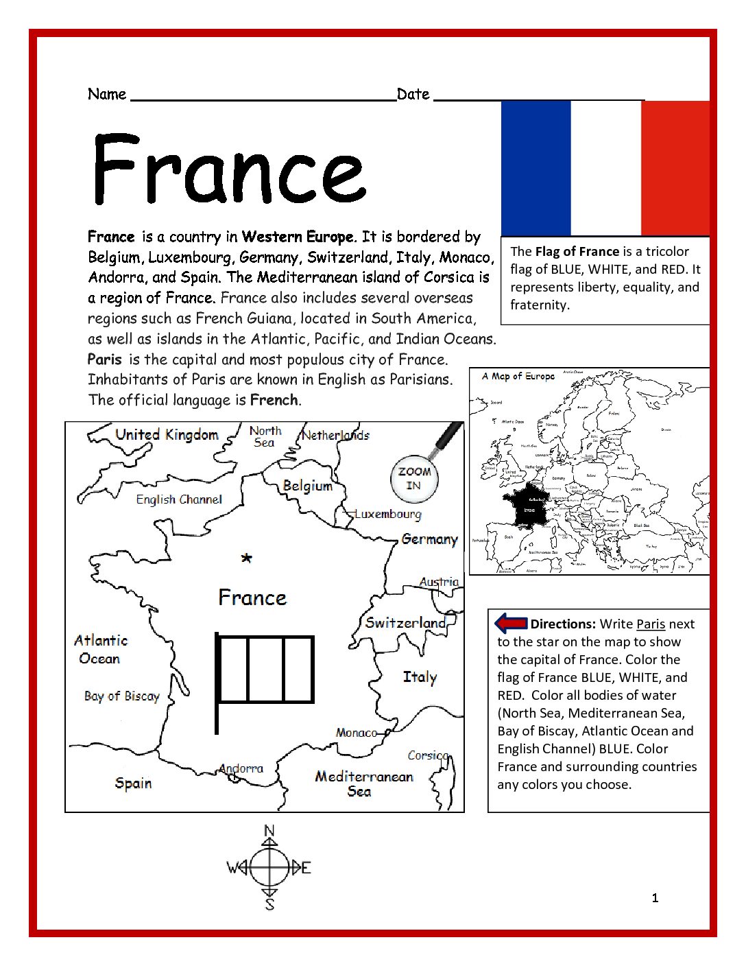
Your students will read a brief introduction to France (location, capital, flag, language), write ‘Paris’ next to the star on the map to show the capital, color the small map and flag, and use the map and compass to answer 7 questions on page 2. Colored pencils and a pen or pencil are needed for this activity. No other prep needed. Basic geography worksheet with a simple map to introduce this country and practice cardinal/ordinal directions.
For use with Interactive Notebooks: After completing the worksheets, students can cut out the map and flag and paste it into the notebook under the topic of (example) Europe / Sub-Topic: France. Under the map and flag, students can write a summary in their own words of what they now know about this country. Collect worksheets for other countries of Europe to add to the notebook! Worksheets for all countries of Europe are available individually or as a discounted COUNTRIES OF EUROPE BUNDLE
You may also be interested in:
Thank you so much for using my worksheets in your classroom! I hope you find them useful. Please browse this site for more printable worksheets with simple maps to introduce your learners to the countries of the world!
Map of France and surrounding includes Belgium, Luxembourg, Germany, Switzerland, Italy, Monaco, Andorra, Spain. Mediterranean island of Corsica. United Kingdrom, Netherlands, North Sea, English Channel, Austria, Atlantic Ocean, Bay of Biscay, Mediterranean Sea.
France Printable Worksheet with Map and Flag
$1.25