Canada Printable Worksheet with Map and Flag
Introduce your students to CANADA with this printable handout of two worksheets (plus answer key). Simple map activity and reading comprehension questions. Print and Go!
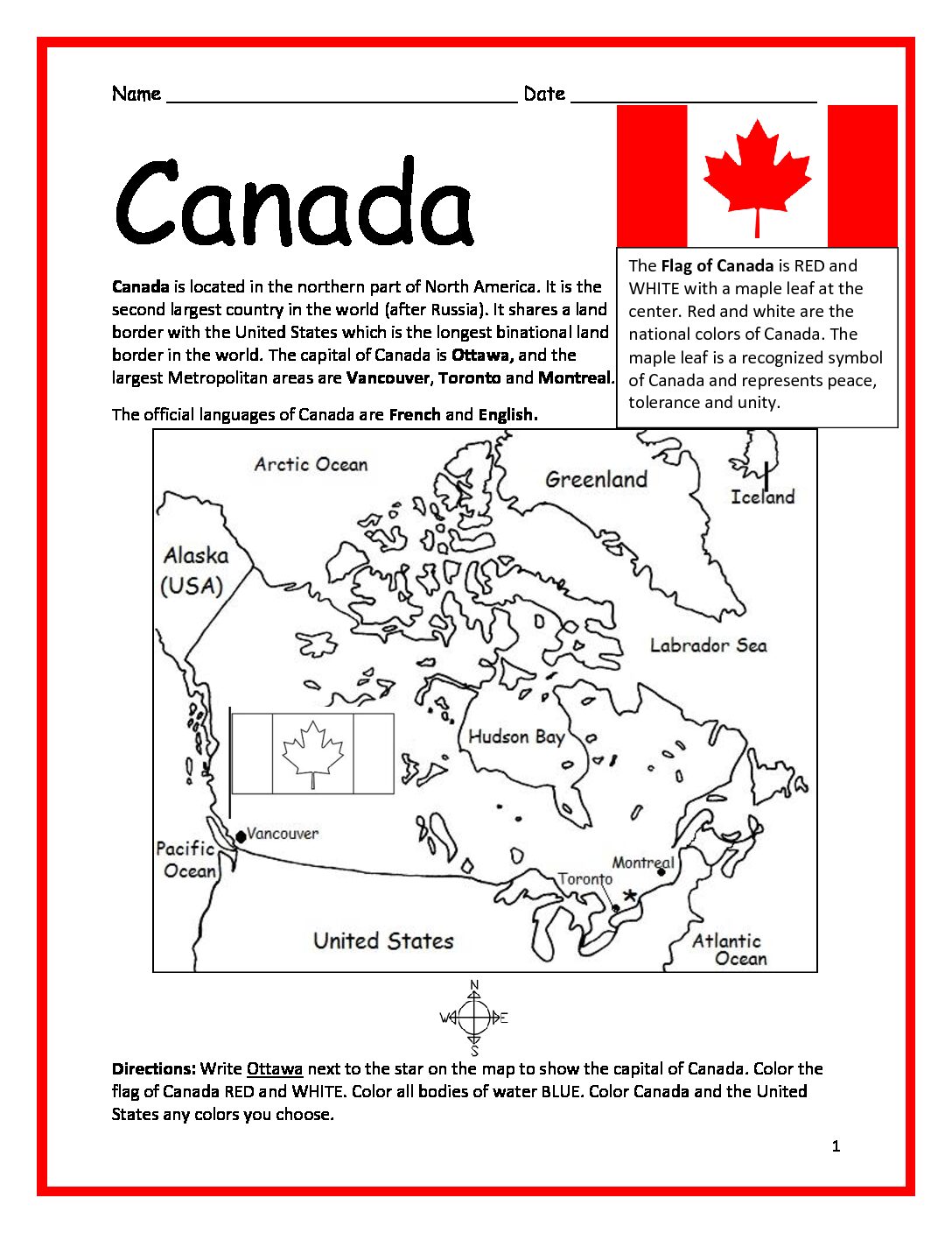
Your students will read a brief introduction to Canada (location, capital, flag, language), write ‘Ottawa’ next to the star on the map to show the capital, color the small flag and map, and use the map and compass to answer 9 questions on page 2. Colored pencils and a pen or pencil are needed for this activity. No other prep needed. Basic Geography worksheet with a simple map to introduce Canada.
For use with Interactive Notebooks: After the worksheets are completed, students can cut out the map and flag and paste into the notebook under the topic of (example) North America/Sub-Topic: Canada. Under the map and flag, students can write a summary in their own words of what they now know about this country. Collect worksheets for other countries of North America (and the world!) to add to the notebook! All available in this store!
Thank you so much for using my printables with your learners! I hope you find them useful. Please browse this store for more! If there is anything at all you need, please contact me through the contact page.
Included on this map: Alaska, Greenland, Iceland, United States, Arctic Ocean, Pacific, Atlantic Ocean, Vancouver, Montreal, Toronto. Cardinal, ordinal directions.