Mexico Printable Activity
Introduce your learners to Mexico and surrounding with this printable activity. Includes two printable worksheets (plus answer key).
Page 1:
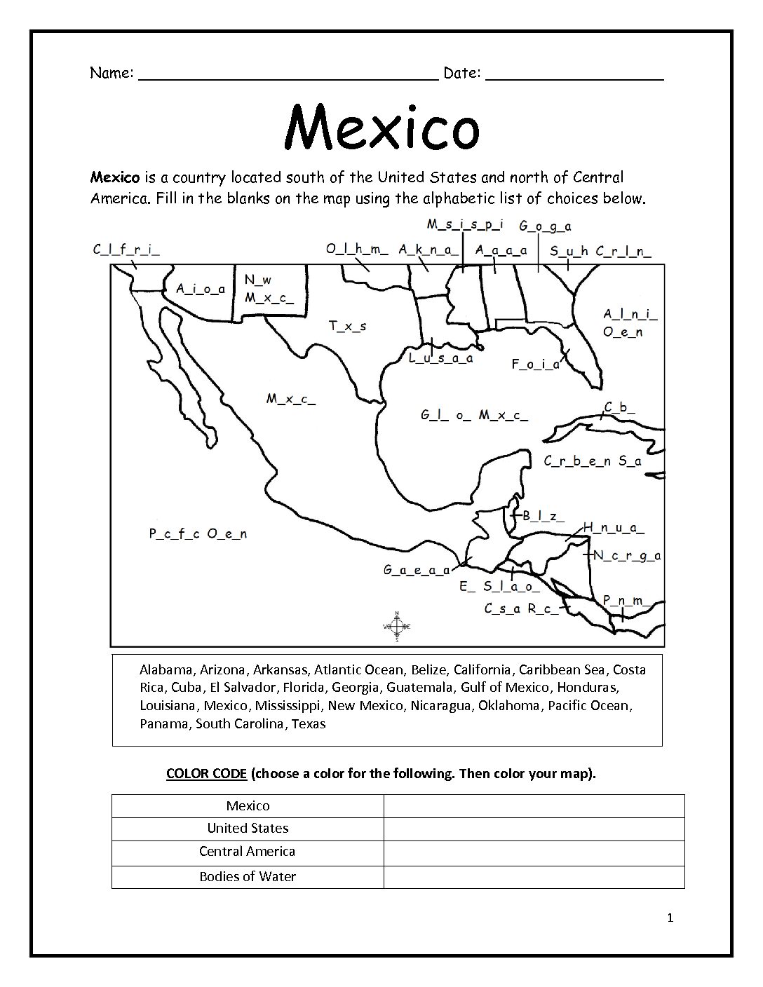
Your students will fill in the blank letters on the map for the countries and US states surrounding Mexico: Alabama, Arizona, Arkansas, Atlantic Ocean, Belize, California, Caribbean Sea, Costa Rica, Cuba, El Salvador, Florida, Georgia, Guatemala, Gulf of Mexico, Honduras, Louisiana, Mexico, Mississippi, New Mexico, Nicaragua, Oklahoma, Pacific Ocean, Panama, South Carolina, Texas.
COLOR CODE: Your students will choose colors for the United States, Mexico, Central America, and Bodies of Water. Then color the map.
Page 2:
Students will use the completed map and compass to answer 7 questions.
Page 3:
Answer Key.
Colored pencils and a pen or pencil are needed for this activity. No other prep needed.
Thank you so much for using my printable worksheets with your learners! I hope you find them useful. Please browse this site for more printable worksheets with simple maps to introduce your learners to the countries of the world!